A seabed observation is useful only if another team can locate it again. For a compact autonomous underwater vehicle, the navigation problem therefore matters as much as the sensor carried through the water. Smaller equipment can change deployment logistics, but the resulting information still needs a reliable position and a clear account of the conditions in which it was collected. Portability and survey quality are related objectives, not interchangeable measurements.
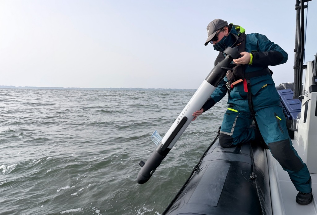
SEABER announced RAVEN on October 26 as a compact AUV for survey and mine-countermeasure applications. The supplier specifies a thirteen-kilogram vehicle, a three-hundred-metre depth rating and maximum endurance of eight hours. It offers sonar with magnetic-detection or camera-and-lighting configurations. These are product specifications and intended uses from the manufacturer; the announcement does not publish an independent customer-acceptance result for every advertised mission. Read the primary source account.
Drift must retain its trajectory condition
The company reports navigation drift below 0.2 percent of distance travelled on straight-line trajectories for its LYNX optical inertial system. It describes a different result on lawnmower survey patterns and a navigation arrangement including a Doppler velocity log. The trajectory qualification matters: removing it would turn a bounded specification into an apparent guarantee for all movement. Buyers need the original condition when assessing whether the claim addresses their own survey.
A position estimate also needs to remain connected to the observation it locates. The practical output is a record that another operator can interpret and, where necessary, revisit. A navigation figure can support that record while leaving the combined sensor, timing and processing chain to be assessed. The release identifies the components, but does not provide a universal end-to-end location error for every payload and environment.
Different payloads create different evidence
Magnetic detection and optical inspection answer different questions about the seabed. A signal suggesting a metallic object is not automatically a confirmed identification, while a camera’s usefulness depends on the view it can obtain. Describing the two configurations separately helps prevent readers from assigning every capability to every vehicle. A chosen mission needs an account of which sensors were installed and which observations supported the final assessment.
The same caution applies to maximum specifications. An endurance maximum, a depth rating and a speed range should not be combined into an unreported single mission profile. The customer’s selected payload and operating conditions determine which combination is relevant. A realistic evaluation would retain that configuration, the survey completed and the information delivered, instead of rewarding the most favorable number from each part of a product sheet.
A smaller deployment footprint changes one part of the cost
SEABER says the vehicle can be deployed by one person and positions it against larger, more expensive AUVs. Its one-third-price claim is a supplier comparison without a complete independent cost methodology in the release. That should remain a commercial positioning statement, rather than a verified conclusion about the total cost of obtaining an accepted survey. Support, recovery, processing and repeat visits can affect that broader outcome.
The compact format is nevertheless a concrete design choice that users can evaluate. A team can compare how the vehicle fits its actual transport and launch arrangements, then measure whether the resulting survey meets the required standard. This connects the deployment advantage to useful work without assuming that smaller equipment automatically replaces every larger platform. Different survey objectives can justify different trade-offs in payload, duration and supporting infrastructure.
The release also identifies acoustic, radio and satellite communications options. These describe different points in a vehicle’s operating cycle, rather than continuous access to every link underwater. Keeping the chosen communications arrangement in the mission record would help explain when information becomes available and which observations are reviewed only after recovery.
The immediate contribution is another compact AUV option with explicit navigation and payload claims. The wider opportunity is to make capable survey equipment accessible to more operating teams, if the full system produces dependable, revisit-ready observations at an acceptable cost. The next persuasive evidence would pair the selected configuration with repeatable survey results and a transparent comparison. That would show how the advertised deployment simplicity and navigation performance combine in a complete task.
Source organizations: SEABER.
This analysis draws on the public sources linked in the text. Send corrections to [email protected].